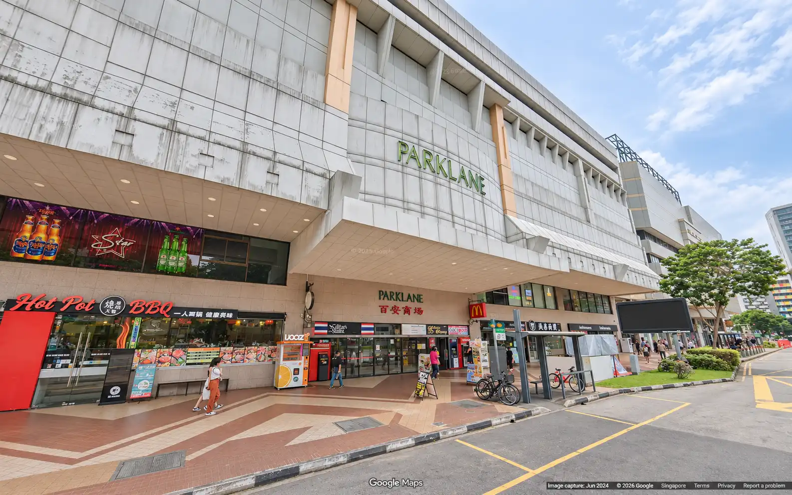
Parklane Shopping Mall – Commercial Space in the Selegie Precinct
Position your business at Parklane Shopping Mall, 35 Selegie Road, District 7. This established commercial development offers a central address in the Selegie–Bencoolen precinct, with retail and office spaces to suit a range of business needs.
Accessibility is a key advantage, with Bencoolen and Dhoby Ghaut MRT stations within walking distance. Nearby bus services along Selegie Road, Prinsep Street and Bencoolen Street provide additional travel options for staff and customers.
The surrounding area offers a wide selection of eateries, cafés and shopping amenities. Nearby developments include GR.iD, Sunshine Plaza and Plaza Singapura, giving businesses access to everyday conveniences and places for lunch breaks or informal meetings.
For businesses seeking a centrally located retail outlet, service space or office, Parklane Shopping Mall is an option worth exploring. Suitability will depend on the individual unit’s layout, approved use and operational requirements.
Enquire About This Property
Check current availability and rental terms, arrange a viewing, or discuss whether the space could meet your business needs.
Share your requirements and we will get in touch. No obligation to proceed.
Rent, availability, specifications and suitability for your intended use are subject to confirmation.
Parklane Shopping Mall: Location & Nearby
Explore nearby transport, selected schools, supermarkets, food centres, recreation, shopping destinations and selected hotels. Select a place to see its location or an estimated walking or public transport route.
Nearby amenities at a glance
Selected places near Parklane Shopping Mall. Distances are approximate straight-line distances from the nearest reviewed development gate to saved map points, not walking distances or times. Gate access restrictions may apply. School points represent campuses; distances are not for Primary 1 admission.
MRT / LRT
BENCOOLEN MRT STATION(DT21)— 241 mBENCOOLEN STREET
DHOBY GHAUT MRT STATION(CC1)— 431 mORCHARD ROAD
DHOBY GHAUT MRT STATION(NS24)— 431 mORCHARD ROAD
Show 1 more mrt / lrt
BRAS BASAH MRT STATION(CC2)— 435 mBRAS BASAH ROAD
Bus stops
BEF SOPHIA RD(07011)— 63 mSELEGIE RD
SCH OF THE ARTS(08079)— 150 mPRINSEP ST
SUNSHINE PLAZA(07571)— 176 mMIDDLE RD
Show 3 more bus stops
BEF BENCOOLEN STN EXIT A(04029)— 190 mBENCOOLEN ST
BENCOOLEN STN EXIT B(08069)— 254 mBRAS BASAH RD
OPP BENCOOLEN STN EXIT B(04019)— 257 mBENCOOLEN ST
Bras Basah Complex— 609 m231 Bain Street Singapore 180231
Bugis Street (Part of Bugis Town)— 634 mBugis 62 to 67 Queen Street, 151 to 166 Rochor Road, 229 to 253 Victoria Street (Odd Nos. only) and 52 Queen Street, 1 to 5 and 7 New Bugis Street, Singapore
Bugis Junction (Part of Bugis Town)— 673 m200 Victoria Street Singapore 188021
Sim Lim Tower(Retail & dining)— 675 m10 Jalan Besar, Singapore 208787
CHIJMES(Retail & dining)— 716 m30 Victoria Street Singapore 187996
United Square Shopping Mall— 1.97 km101 Thomson Road, Singapore 307591
People's Park Complex— 1.98 km1 Park Road Singapore 059108
ION Orchard— 1.99 km2 Orchard Turn
Lucky Chinatown— 2.00 km211 New Bridge Road Singapore 059432
Use the map below to select gates, review entrance choices and request walking or public transport directions. This overview lists the saved selections; map filters do not change it. Sources and data dates are listed below.
Calculating walking route…
List distances are straight-line estimates. Walking routes start at the named gate and exclude walking within the development or indoors. Mapped shop and food-centre points may differ from entrances. Park walks use a map reference point unless an entrance has been reviewed. Check access restrictions, opening hours and temporary closures; routes do not confirm sheltered or step-free access. Public transport estimates include buses and MRT/LRT, use current services and include walking and waiting; they are not live bus arrivals. Walking sections are dashed, bus routes are blue and rail routes are purple. School distances are not for P1 admission. Lists and source coverage may be incomplete.
Food & Markets: NEA via data.gov.sg; retrieved 19 Nov 2026. See the source for its coverage period. Singapore Open Data Licence. Covers NEA-listed centres and selected supplementary food locations, not all restaurants, coffee shops or private food courts.
Supplementary market addresses, checked 29 Oct 2026: Market Street Hawker Centre address. These are separately sourced locations, not NEA dataset points; postal-code destinations are approximate until entrances are reviewed.
Parks & Recreation: NParks park points and SportSG facilities, via data.gov.sg, retrieved 19 Nov 2026. Singapore Open Data Licence. Park reference points are not entrances or nearest boundaries; large parks may have nearer entrances outside the source-point search. SportSG coverage excludes Dual Use Scheme venues. Selected attractions and museums use separately sourced official addresses, matched by exact postal code through OneMap; these are not part of the NParks / SportSG datasets. Check operator access, fees, bookings, current opening status and source coverage dates.
Supplementary food and market addresses checked 29 Oct 2026. Source links: nea.gov.sg. Building points located through OneMap; indoor walking is excluded.